North Carolina Visitors Network
North Carolina
Print Maps

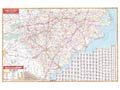
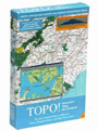
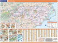
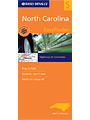
Everybody needs maps. We offer a broad selection of North Carolina print maps here for sale using our secure server.
If you are looking for ONLINE maps for any particular part of the state click here, enter in the name of the town you are looking for and you will be given an option to look at zoomable online maps for that area. If you are looking for books about various North Carolina subjects, (NC, NC hiking trails, NC crafts, etc.) visit our North Carolina bookstore.
UniversalMAP Wall Map: North & South Carolina
TOPO! North Carolina High Country and Piedmont
Rand McNally North Carolina State Wall Map
Rand McNally EasyFinder: North Carolina
Rand McNally Foldmap: North Carolina
National Geographic Guide Map: North Carolina
Rand McNally Foldmap: Fayetteville
Rand McNally Foldmap: Raleigh, Durham
Rand McNally Folded Map: Greensboro/High Point
Rand McNally EasyFinder: Charlotte & Vicinity
Rand McNally Foldmap: Gastonia, Gaston County
Rand McNally Foldmap: Wilmington, Jacksonville
DeLorme Atlas & Gazetteer: North Carolina
Trails Illustrated Map: NC -Pisgah Ranger District
National Geographic Destination Map: Great Smokies
Trails Illustrated Map: NC Fontana & Hiwassee
Trails Illustrated Map: NC - Nantahala & Cullasaja
Accurate Maps: Concord/Kannopolis
Accurate Maps Folded Map: Watauga County
Accurate Maps Folded Map: Rowan County
Sanford / Lee Counties: Rand McNally Map
Accurate Maps Street Atlas: Fayetteville
Rand McNally Downloadable Map: Winston-Salem, NC
Trails Illustrated Map: TN - Great Smoky Mountains


Sponsor
Visit Our Sponsors


WHERE DO YOU WANT TO GO TODAY ?
North Carolina Topics
Scroll down, hi-lite and Select.
North Carolina Towns

Scroll down, hi-lite and Select.
North Carolina Counties

Scroll down, hi-lite and Select.